
The platform
Built for the way a reappraisal actually runs.
Revaluator isn't a general-purpose GIS tool with assessment bolted on. Every screen exists because a county needed it during a live revaluation — and most of them were shaped by the assessors using them.
NEW Valuation
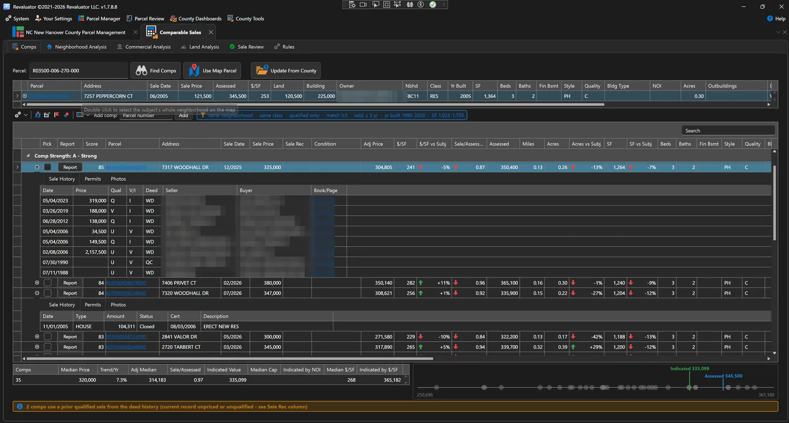
Comparable sales that show their work.
Every value a county sets is a value a taxpayer can appeal, and the appeal turns on evidence. Comparable Sales finds qualified arm's-length sales, scores them, adjusts every price to the statutory valuation date — and shows every screen, weight and calculation, because the board hearing is where the work gets checked.
- Scored comps with a per-comp report showing the arithmetic line by line
- Time adjustment on a repeat-sales index built from the county's own paired sales
- IAAO ratio studies for neighborhoods, commercial types and vacant land
- Sales verification queue, printable comp sheets and appeal packs
Assignment
Bundles turn a county into a week's work.
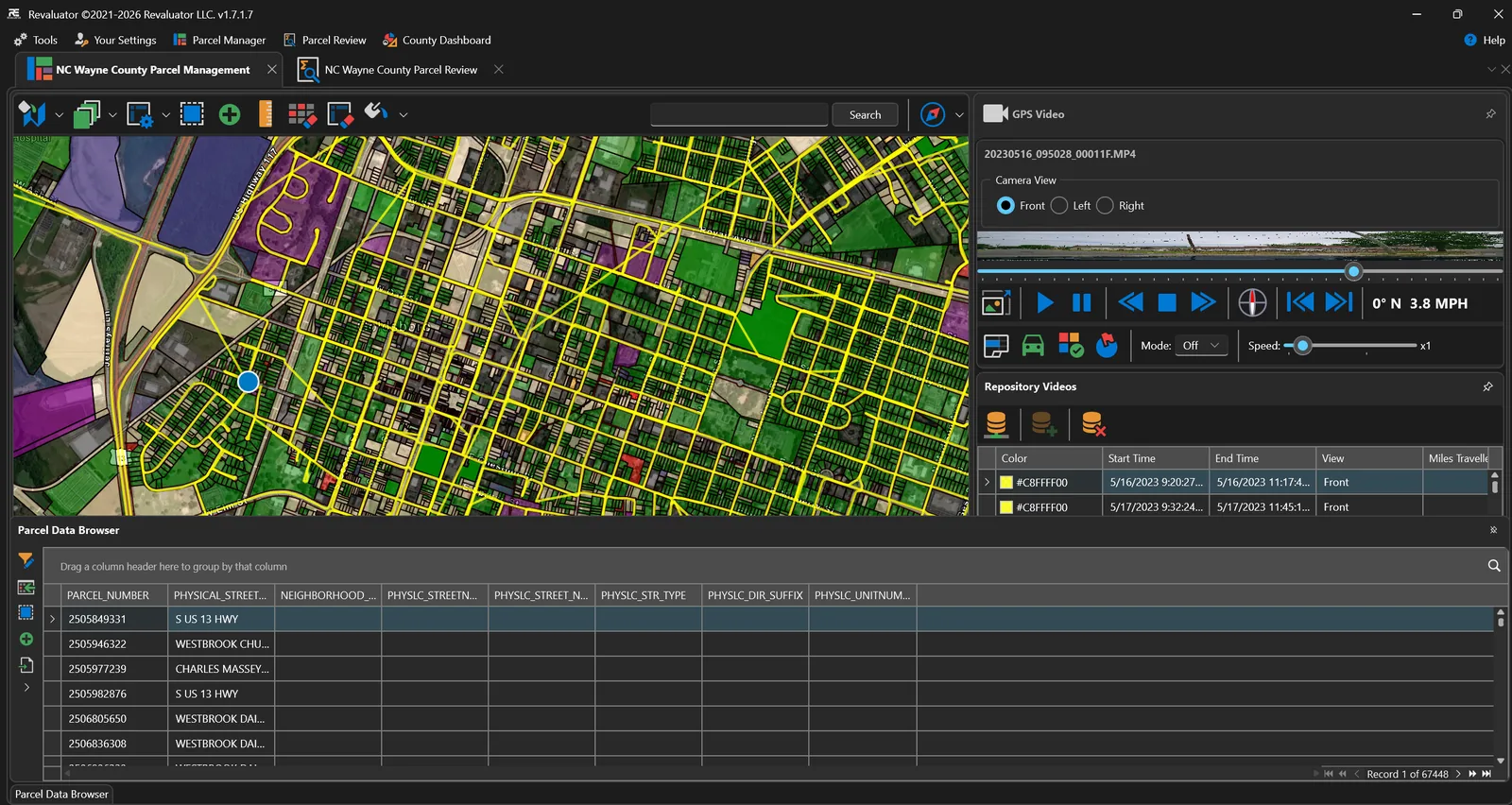
A bundle is a work packet: a defined set of parcels handed to a named field user. It's how a county of eighty thousand parcels becomes something a crew can actually be held to.
- Create bundles by selection, import a parcel list, or draw on the map
- Add and remove parcels while work is in progress
- Export bundle contents and status to Excel
- Bundle GPS data auditing to validate coverage
Review
QA without opening every card.
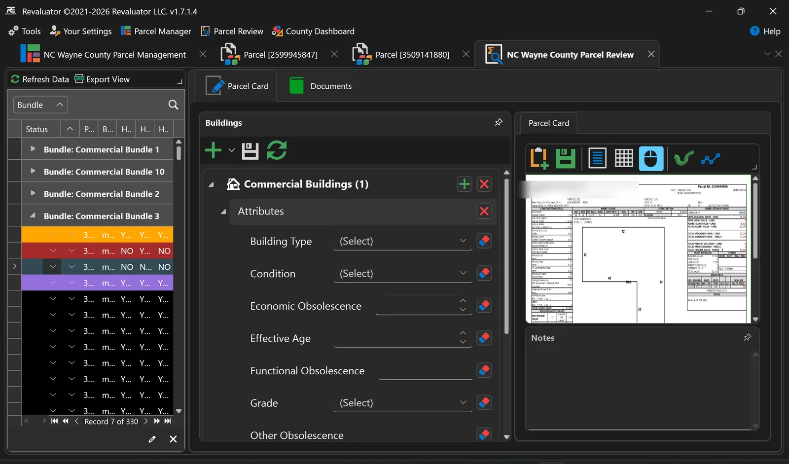
Parcel Review is a separate workflow for the office. Move through submitted work by bundle, check notes and building data, and accept or reject — with the field user's imagery right there as evidence.
- Review queues organised by bundle and status
- Notes and building review side by side with the parcel card
- Reject work back to the field user with a reason
- Change tracking so you can see what was altered and when
Evidence
Photograph it once, keep it forever.
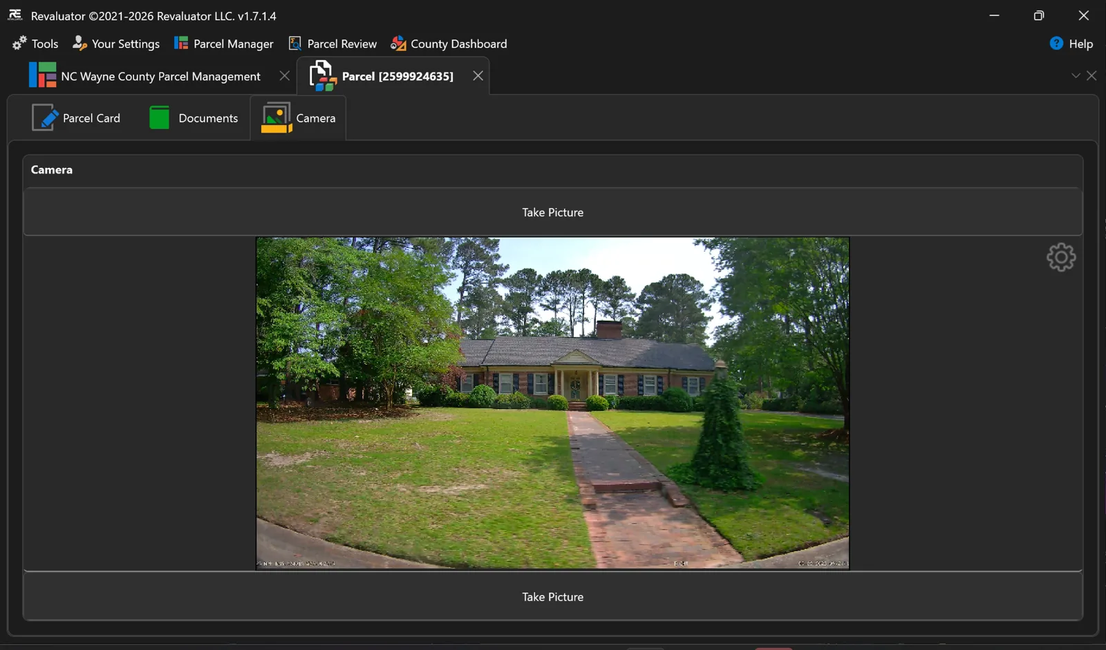
Imagery is attached to the parcel, not to somebody's camera roll. Capture in the app, import from a mobile device, edit and tag — then it's part of the record when a taxpayer appeals two years later.
- Built-in camera capture for photos and video
- Mobile imaging and routing companion for Android devices
- Image editor and image-to-parcel tagging
- Aerial and oblique imagery through EagleView integration
Configuration
Your county's rules, not a vendor's defaults.
Counties don't agree on what a building record looks like. The County Object Modeler lets the data model itself be defined per county — object types, field schemas and editing rules that drive the screens and validation.
- Define object types and field schemas per county
- Switch active county datasets, layers and card templates
- Report designer for county-specific printouts and exports
- Custom integrations and automation built to order
Everything else
The full feature list.
Mapping & data
Shapefile import, parcel data import and browsing, map geometry selection, shape measurement, colourised status maps with configurable colour rules, terrain view, and custom county-defined layers — zoning, flood zones, market areas — online or offline.
Field & GPS
GPS support with live tracking and logging, follow and centre modes, breadcrumb trails, and bundle GPS auditing that proves a route was actually driven.
Routing & navigation
Parcel routing with turn-by-turn navigation, route setup per bundle, and drive-order planning so a day in the field follows the map instead of fighting it.
Video & imagery
GPS video with telemetry import and export, dash-camera capture support, frame stepping and still capture, a video upload centre, repository video management, image editor, mobile image import and parcel image tagging.
Third-party imagery
EagleView aerial and oblique imagery with its own in-app navigator, street-level reference imagery, and per-parcel image galleries kept with the record.
Valuation & analysis
Comparable sales search with scored results and per-comp reports, repeat-sales time adjustment, IAAO ratio studies by neighborhood, commercial income analysis, vacant land studies, sales verification and printable appeal packs.
Parcel & buildings
Building support for existing structures and new construction, subtype editors for residential, commercial, industrial and outbuildings, notes, and Apex Sketch integration.
Bundles & assignment
Work packets built by selection, list import or drawing on the map; categories per kind of work, splitting and moving between categories, per-user assignment and Excel export of contents and status.
Review, audit & history
Office QA queues by bundle and status, accept and reject with reasons, parcel status change history, and change tracking that shows what was altered, by whom, and when.
Documents & parcel cards
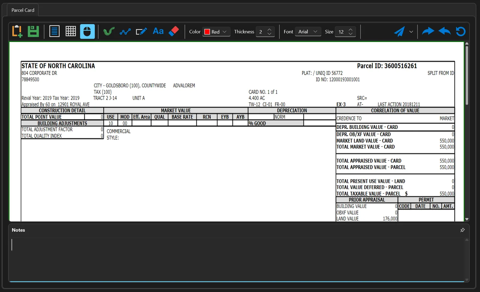
Attach any file type to a parcel — deeds, permits, correspondence — with built-in viewers for documents, spreadsheets and county property record cards, including card markup tools.
Offline mode
Take a bundle to the field with no connectivity: a local working copy of parcels, data and imagery, checked back in when you're online — with ownership rules so two people can't collide.
Dashboards & reporting
County dashboards for progress and workload, a dashboard designer for building your own, a report designer for county-specific outputs, and printing throughout.
Collaboration
In-app chat between field and office, a scratch pad for working notes, and one-click parcel callouts that put every tool a parcel needs on a single toolbar.
County modelling
The object modeler defines object types, field schemas, editing rules and picklists per county — including CSV picklist import and data mapping — so the screens match the county, not the vendor.
Administration
User management with roles and security levels, permission-gated tool modules, county switching, and admin functions for county datasets.
Integration & automation
CAMA integration for building and image updates, automated data entry for new construction, scheduled import and export routines, and county-specific customisation.
CAMA integration and county-specific customisation are development work. They're scoped against the system you already run and the way your office works — see what we already connect to, and talk to us about anything you don't find there.
Want to see it against your own data?
We'll load a slice of your parcel data and walk your team through the workflow end to end.